Mimi Sadler
Participant Statement
Mimi’s career as an historical architect has focused on creatively adapting older buildings and their neighborhoods to include new uses, with a goal of generating modern solutions that preserve existing structure and enhance essential character. Her education at Williams College and the University of Virginia nurtured a fascination with the ways that humans and their built environment are transformed in response to cultural and historical change. The joy of experiencing architecture for her is directly related to determining the essential character of a place, and expressing its evolution. The goal of preservation is quite simply to protect and save that which is good. The evolution of each place, even museum properties, is key to its survival.
In 1997 Mimi cofounded Sadler & Whitehead Architects, PLC with her husband Camden Whitehead. Under her leadership the firm partnered with hundreds of property owners and development teams to plan and execute a wide range of projects that transformed underutilized buildings into vibrant new settings for dwelling, recreation, and business. Teaming with colleagues across the state she produced nomination reports that document individual properties and historic districts for listing on the National Register of Historic Places. In summer 2020 Mimi retired from full-time work in order to pursue her interests in promoting design excellence, thoughtful preservation, and social justice.
Project Statement
The patterns expressed by mapping several Richmond neighborhoods and the Virginia State Capitol illustrate:
The power of green space to enhance public and private property
The vulnerability of unprotected historic fabric in working class neighborhoods confronted by urban renewal and transportation priorities
The ability of politically and socially powerful groups to protect, insulate, isolate, or destroy
Pattern 1 - Capital Square, Richmond
2/2/2020 / 5 pm
Capital Square, Richmond
Richmond’s streets and neighborhood parks
digital figure-ground map created for city master plan
PowerPoint tools
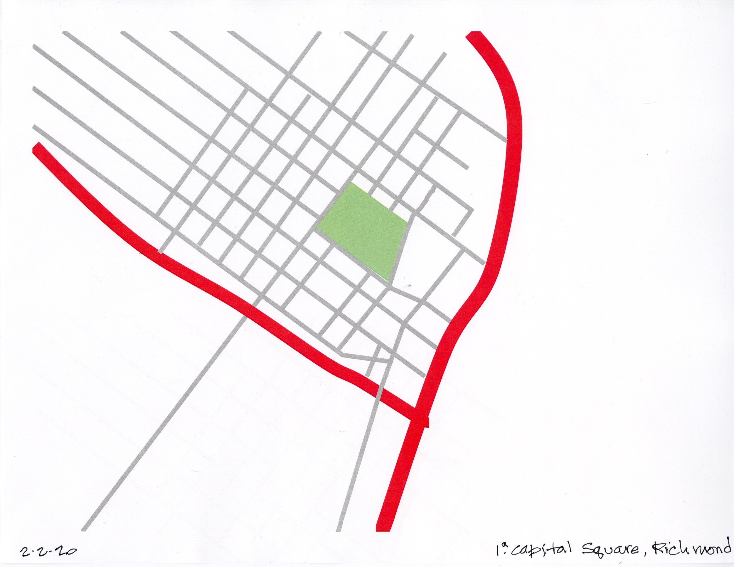
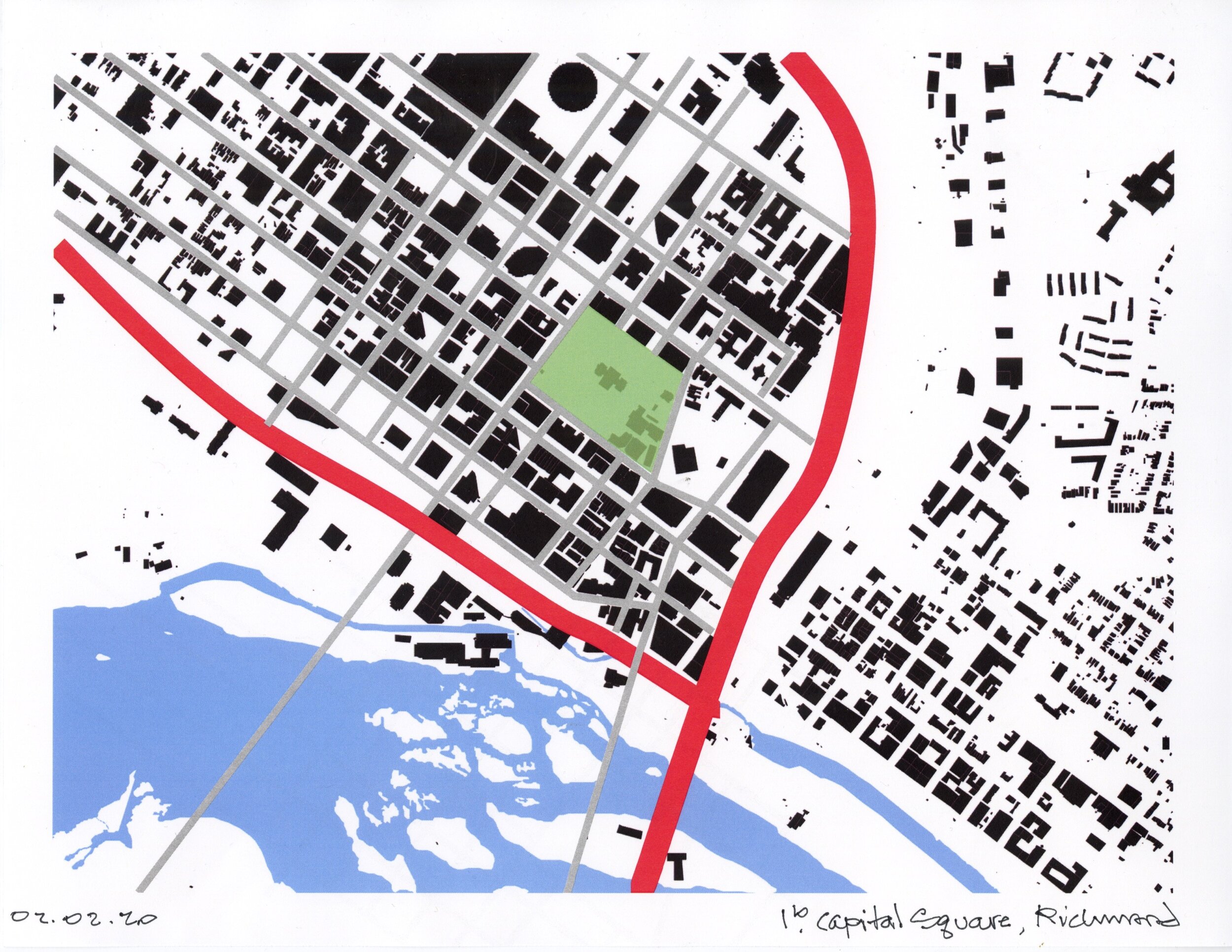
As the center of state government Capital Square is where citizens engage with elected leaders and their staff. Its position in downtown, its relatively high elevation, and its articulation in the urban grid indicate the importance of this place. This public park in the heart of downtown Richmond is defined by the government buildings that form a wall at its perimeter and is dominated by the temple-form Capital building. The square is an aberration in the surrounding grid of streets. The Capital building itself and the square that provides its verdant setting vividly symbolize ideals of democratic government and the importance of citizen participation. The park invites citizens and lawmakers to engage each other, to eat lunch on the well-tended grounds or to read a book on the steps of the Capital.
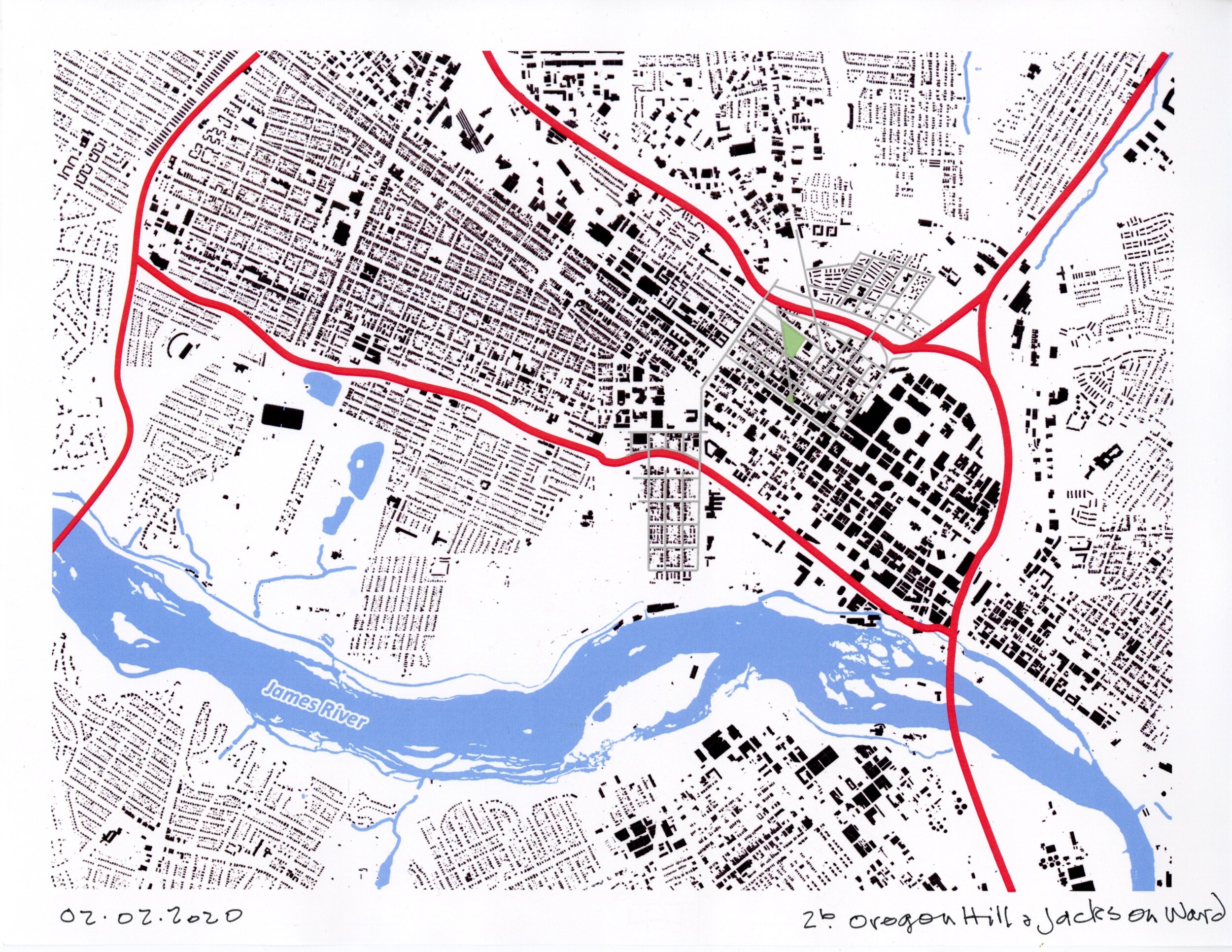
Pattern 3 – Oregon Hill and Jackson Ward, Richmond
02/02/2020 / 4 pm
Oregon Hill and Jackson Ward, Richmond
Richmond’s streets and neighborhood parks
digital figure-ground map created for city master plan
PowerPoint tools
Jackson Ward and Oregon Hill are residential neighborhoods linked by one of Richmond’s primary north-south corridors, Belvidere, which is Route 1. The two neighborhoods were originally defined by an uninterrupted urban grid that was integrated into the urban pattern. Construction of the Interstate in the late 1950s and the Downtown Expressway in the mid-1970s cut through both neighborhoods and threatened their destruction. These two historic working-class neighborhoods retain integrity despite the scars resulting from highway construction, the expansion of VCU’s campus and the development of City-owned or VCU-sponsored facilities, like the Convention Center and the Virginia Bio+Tech Park. As illustrated by the urban pattern, both neighborhoods preserve a defining grid of streets, although scar tissue from highway construction remains evident in mapping and on the ground. The fragile fabric of Jackson Ward continues to be eroded because that neighborhood sees much heavier traffic and more intense development pressures. The destruction wrought by highway construction and VCU’s expansion awakened effective activism in both neighborhoods whose engaged citizens have fought to save both neighborhoods.
Pattern 2 – The Fan District, Richmond
2/1/2020 / 2pm
Fan District, Richmond
Richmond’s streets and neighborhood parks
digital figure-ground map created for city master plan
PowerPoint tools
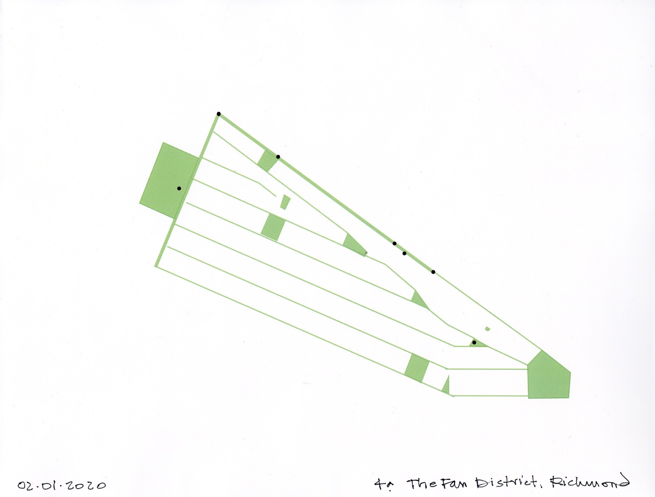
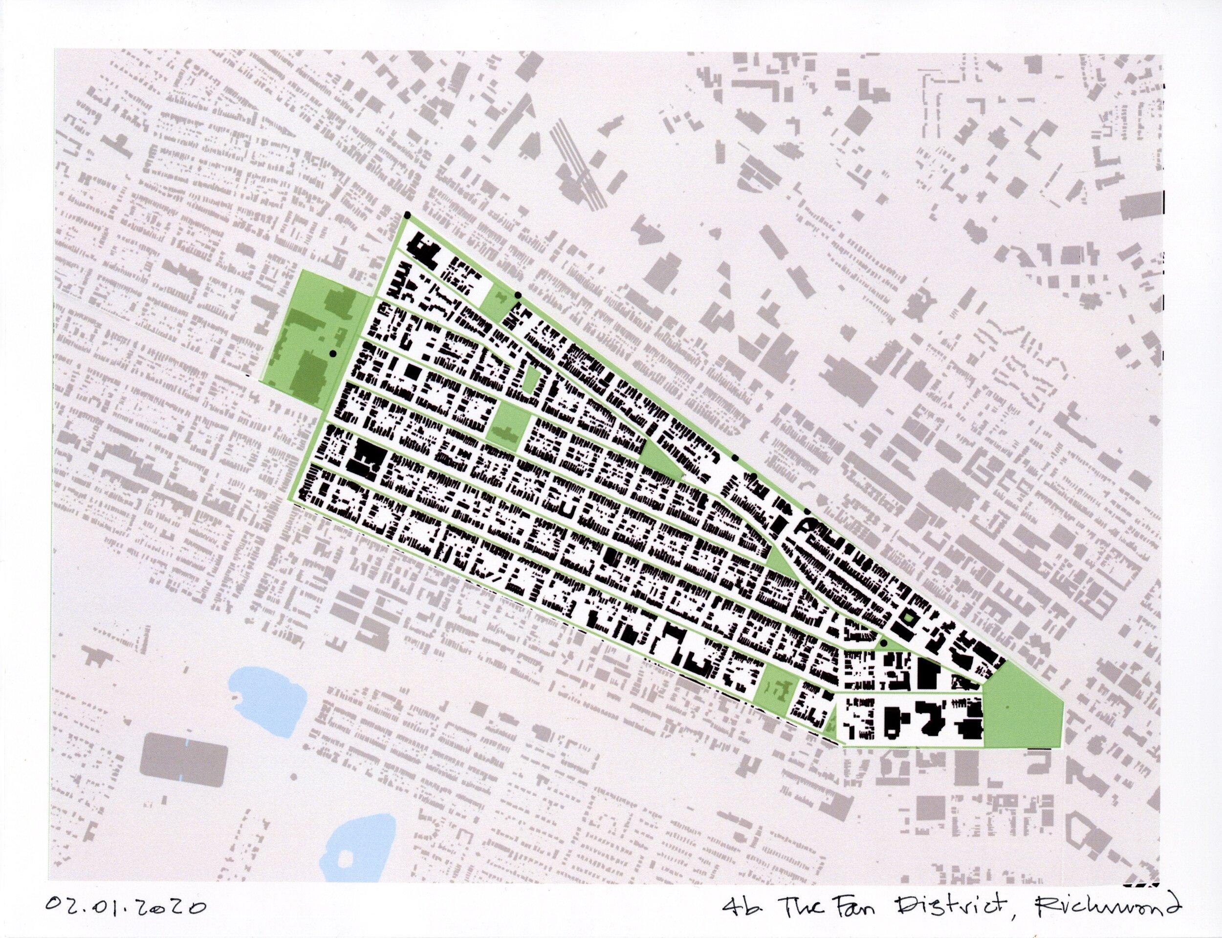
The angled streets of the Fan District start at Arthur Ashe Boulevard, where the west end of the neighborhood is marked by the park-like setting of the Virginia Museum of Fine Arts and the Virginia Museum of History & Culture. The neighborhood terminates at Monroe Park, a multi-function public green space that buffers the Fan from Downtown. It’s an urban neighborhood shaded by mature street trees and enhanced by small public parks, grocery stores and restaurants. It is one of Richmond’s most intact historic neighborhoods. With its historic density, and proximity to VCU, the Fan’s converging tree-lined streets and parks maintain a healthy vitality. The significantly evolved statues that punctuate Monument Avenue on the district’s north edge, are now recognized as significant public protest art. The city’s newest public monument, Rumors of War is sited at the neighborhood’s west edge.
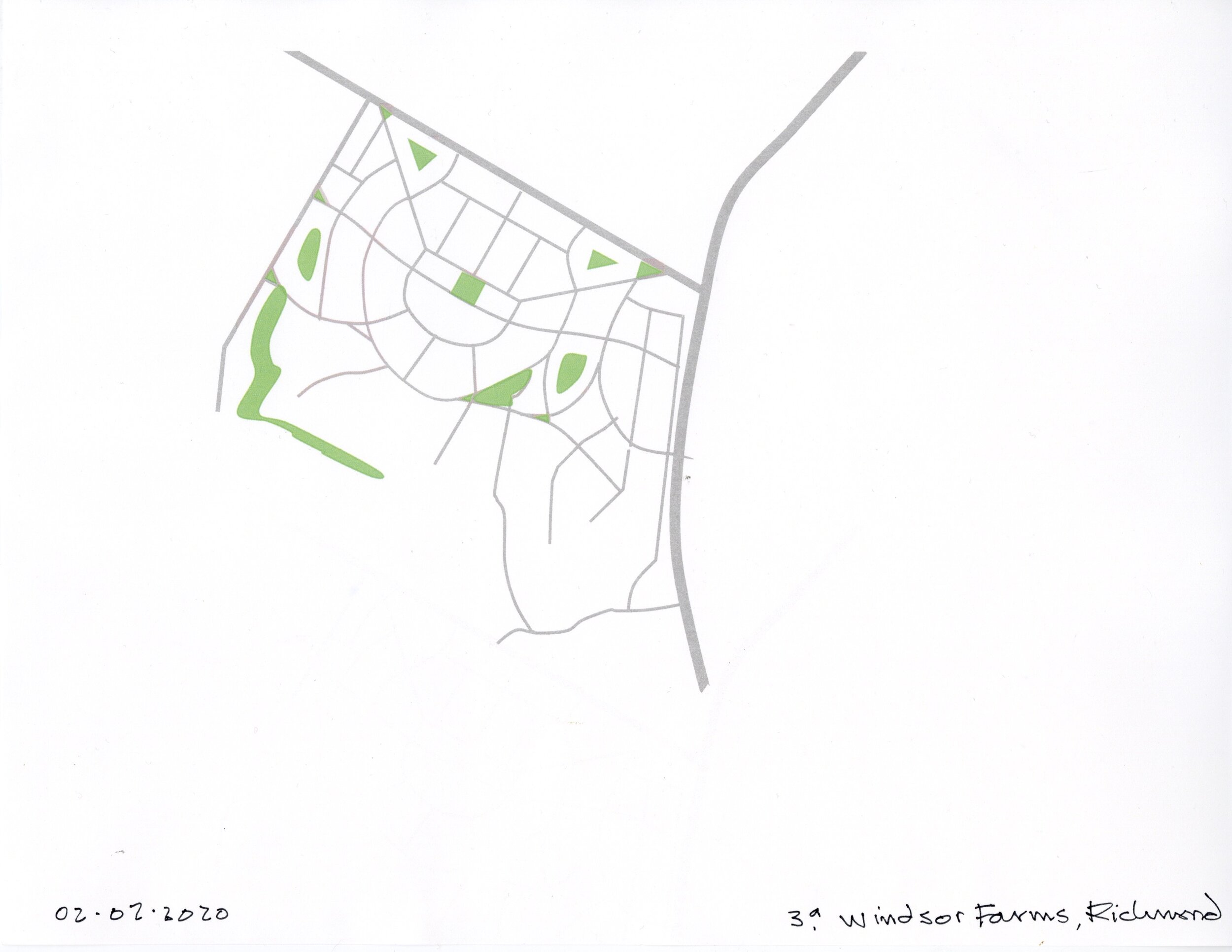
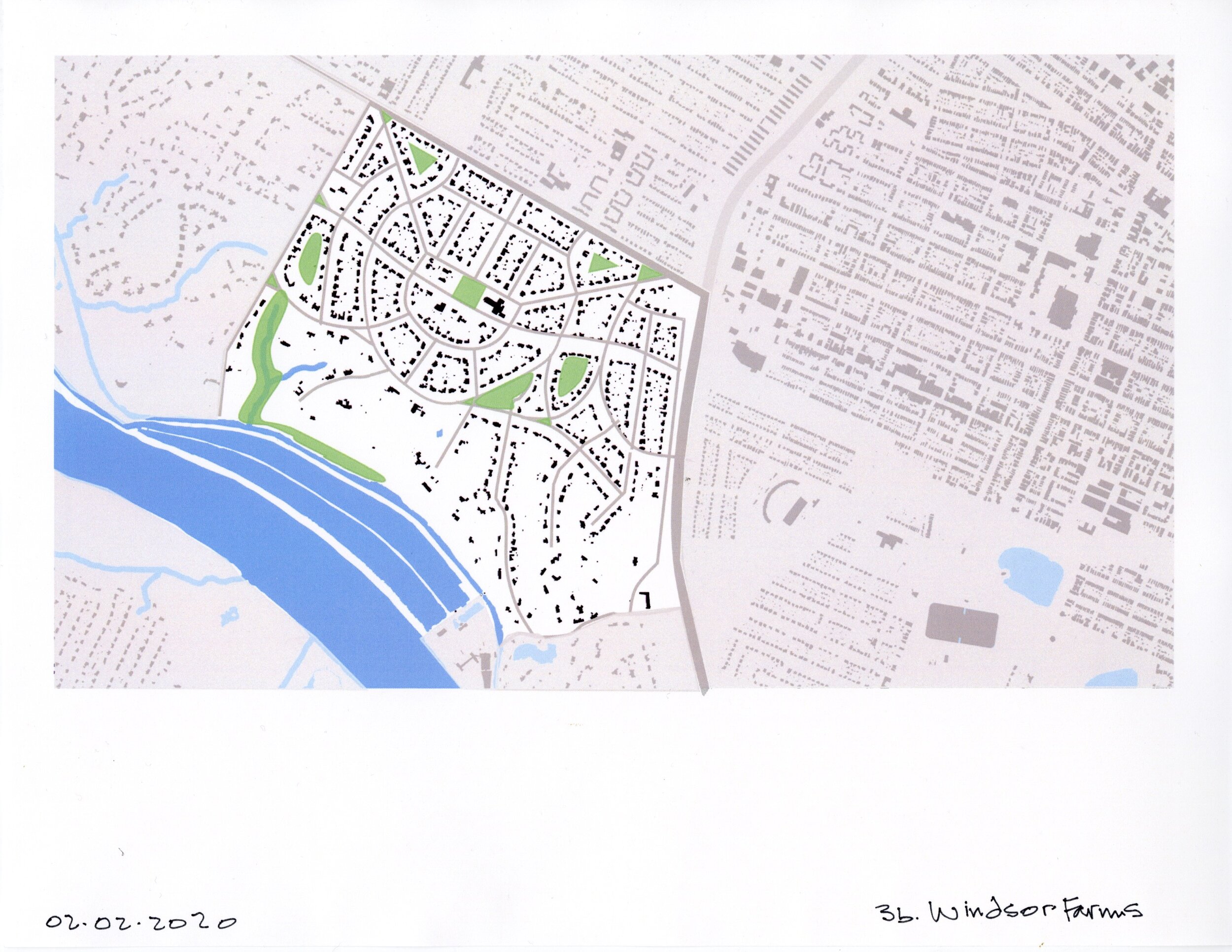
Pattern 4 – Windsor Farms, Richmond
2/2/2020 / 2pm
Windsor Farms, Richmond
Richmond’s streets and neighborhood parks
digital figure-ground map created for city master plan
PowerPoint tools
Windsor Farms is sited on the north bank of the James River and is walled off from adjacent commercial and residential areas by Cary Street Road on the north, Lock Lane on the west, and the Powhite Parkway on the east. For those who don’t frequent the neighborhood, being lost on its beautiful maze-like streets is a confounding experience that enhances a sense that the visitor may not belong. Defined by curving streets, carefully tended properties, and traditional architecture, Windsor Farms is an exclusive residential enclave. The neighborhood enforces conformance to its 1926 subdivision plan by requiring that projects be approved by a neighborhood Architectural Review Committee. I often drive through this neighborhood and marvel over its deliberate site plan, and its relentless adherence to tradition.


